Research Aims To Document And Reduce Vehicle Collisions With Wildlife
October 31, 2006
|
A group of researchers from the University of Northern British Columbiahas been instrumental in developing and implementing a high-tech toolthat will provide new information in efforts to reduce vehiclecollisions with wildlife. Mobile GPS units have been outfitted with buttons that allow users toselect when moose or deer are seen along roads, either alive or dead.Precise information about the time of day, date, and location arestored in the unit and downloaded to a computer for further analysisand mapping. Ten of the units have already been distributed to localtruck drivers, who have been recording data along highways heading outof Prince George to the north, south, east, and west since July.Researchers are hoping to continue working with the local truckingcompanies to collect data until the summer of 2007. “This is the first time we’ve ever had really accurate data on whereanimals are being spotted and where either collisions have occurred orare likely to occur,” says UNBC researcher Roy Rea. “We’ve analyzed 10years of ICBC claims data and information from the Ministry’s WildlifeAccident Reporting System but these two sources must be combined withmore current and site-specific information so that countermeasures forcollision hotspots can be developed. When we add the GPS data, we’reable to more precisely predict where animals are likely to be, both atdifferent times of year as well as at different times of day.” ICBC has identified October as Zero Crash Month. Last year, in themonth of October alone, there were 510 wildlife collisions in NorthernBC – the highest number in four years. In fact, close to 30% of allcollisions around Northern BC during October involve wildlife. On anannual basis for the entire province, the average numbers (over thelast five years) are significant:
“Despite our attempts to reduce collisions with wildlife, we continueto see a high frequency of these crashes,” says David Dickson of ICBC.“Our relationship with UNBC researchers has been providing us withvaluable information that will enable us to focus our efforts inimplementing measures that will hopefully reduce the number of thesecollisions.” The research is being funded by ICBC, with support from Autoplanbrokers and the RoadHealth Task Force. Others involved include LomakBulk Carriers, Excel Transportation, Grandview Transport, theVanderhoof ambulance service and fire department, Yellowhead Road andBridge, the RCMP, the Ministry of Transportation and Highways, and theWildlife Collision Prevention Program. The UNBC researchers involved with the project are Roy Rea, Eric Rapaport, Nicole Klassen, Mike Hurley, Dexter Hodder, Scott Emmons, and Alim Karim. Contact: Roy Rea, Ecosystem Science and Management program, UNBC – 250.960.5833 Rob van Adrichem, Director of Media and Public Relations, UNBC - 250.960.5622 |
Downloads
Click on the image to download the high-resolution version.
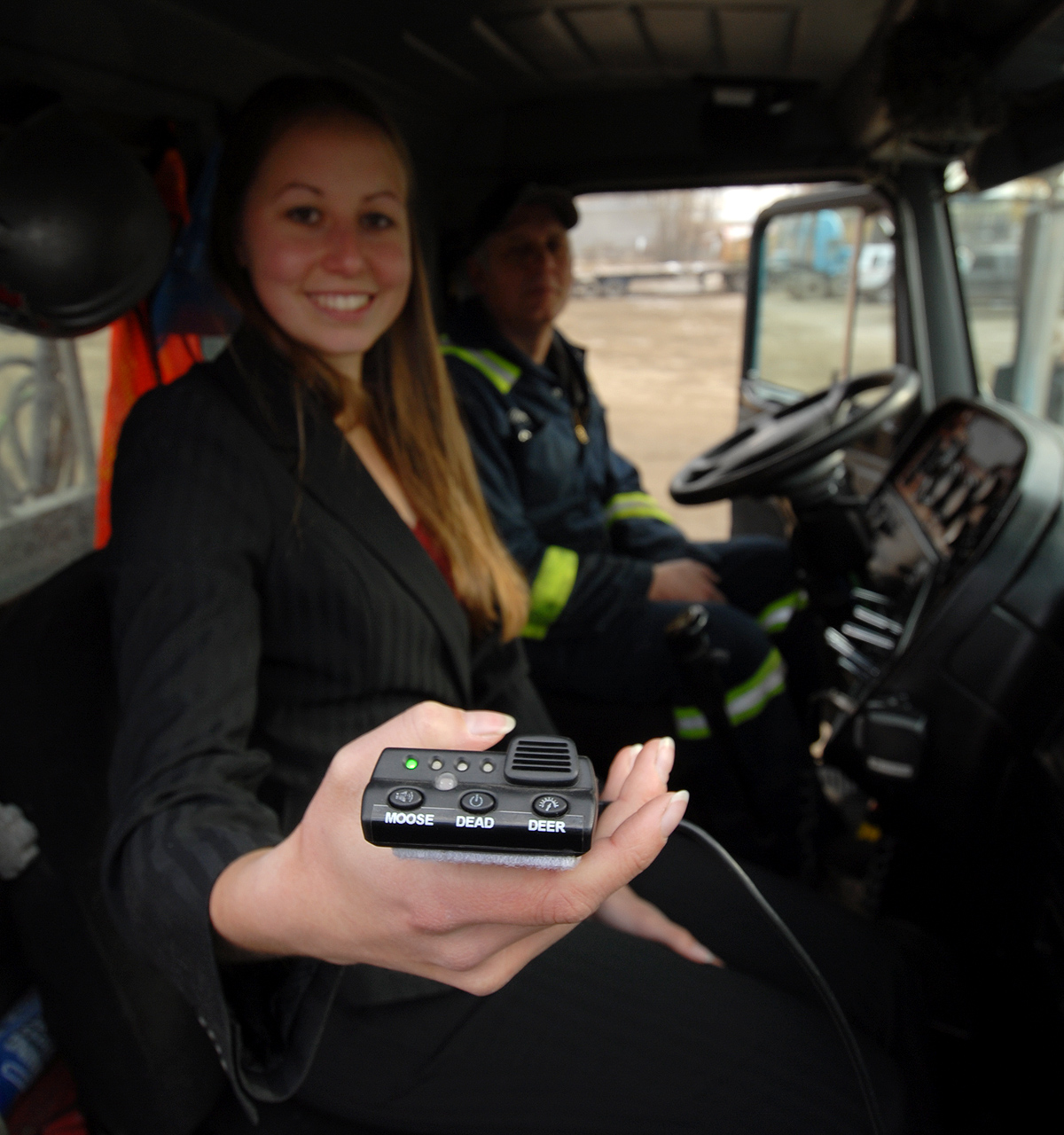
UNBC student researcher Nicole Klassen holds the GPS unit that trackscollisions with wildlife on highways around Prince George. One of thetruckers using the new technology is Doug Therrien of ExcelTransportation.
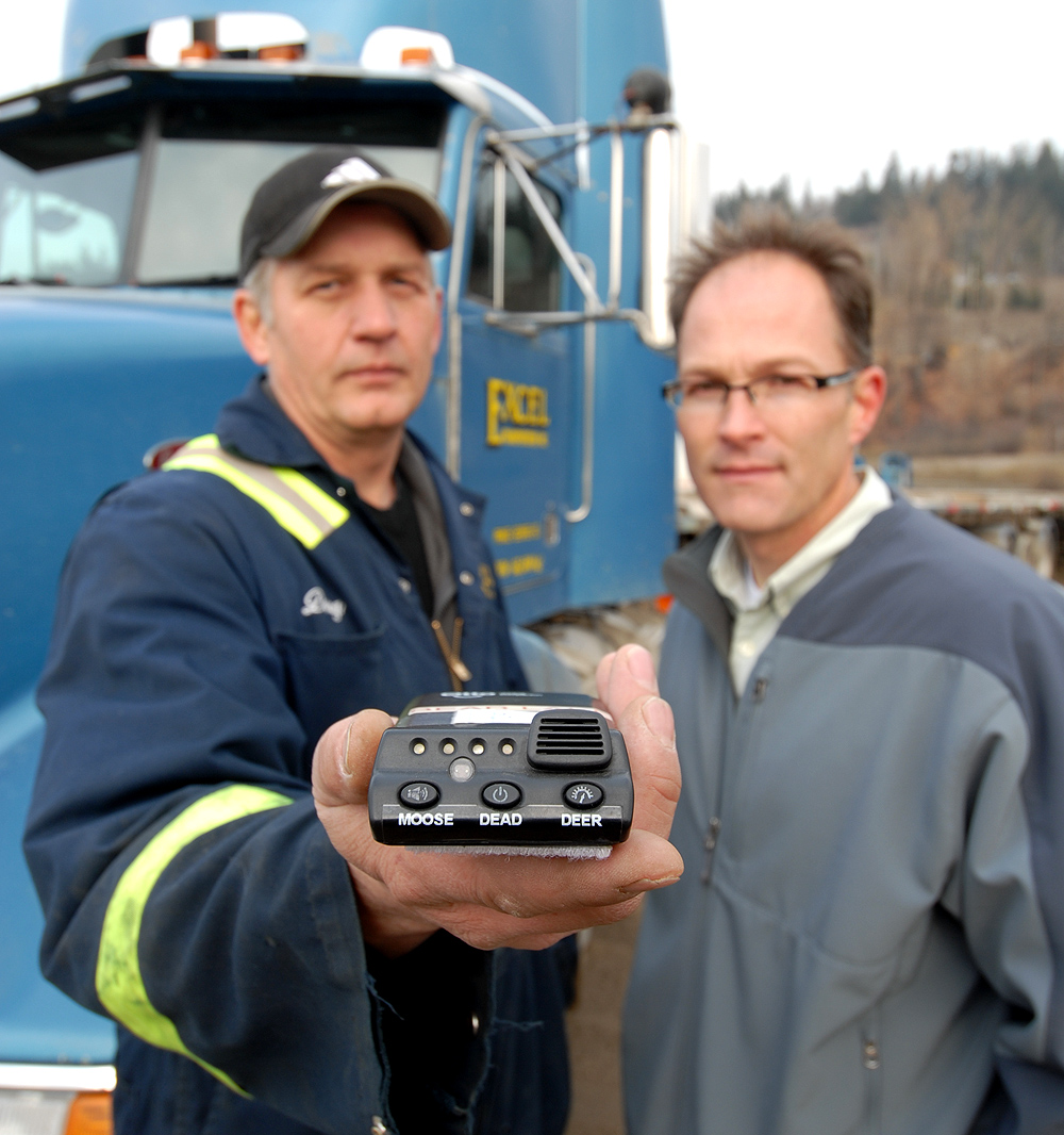
Doug Therrien of Excel Transportation shows the new GPS units thatlocal truckers are using to track sightings of deer and moose alongcentral interior highways. He is pictured here with UNBC researcher,Roy Rea (right). |